Kategorie:Karten
Die Kategorie Karten zeigt im oberen Teil Karten von Ländern und Regionen, nach Ländern alphabetisch sortiert.
Siehe auch
- Die Flaggen von Ländern und Regionen zeigt die Kategorie Flagge.
Europa
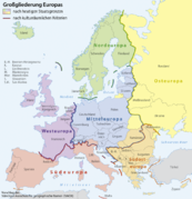
Europa
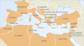
Mittelmeer-Anrainerstaaten


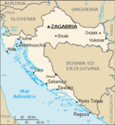
Balkan-Halbinsel
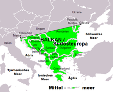
Balkan

Belgien
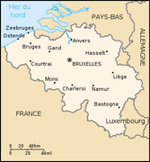
Belgien
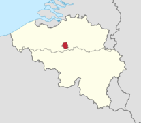
Brüssel in Belgien
Belgien mit seinen wichtigsten Städten


Bulgarien
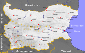
Bulgarien
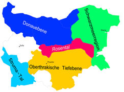
Bulgarien (Weinanbau)


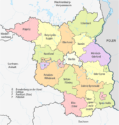
Deutschland
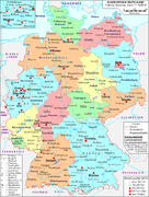
Deutschlandkarte 2010
Deutsche Weinanbaugebiete
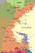
Baden 1945
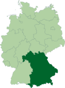
Bayern
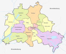
Berlin
Brandenburg
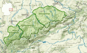
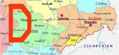
Erzgebirge
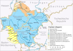
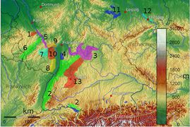
Franken
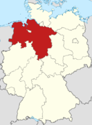
Niedersachsen
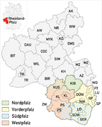
Pfalz
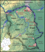
Rheinhessen
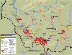
Saarland
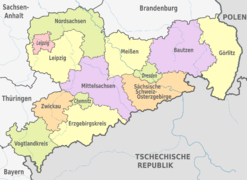
Sachsen
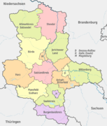
Sachsen-Anhalt
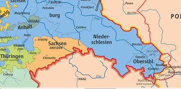
Schlesien im Deutschen Reich 1871-1918
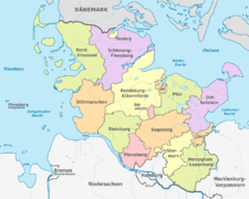
Schleswig-Holstein
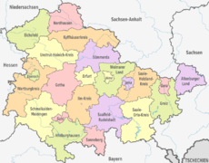
Thüringen
Westfalen
Westfalen (Gebiet des LWL)


.png)

_-_de_-_colored.svg)


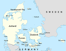
Dänemark
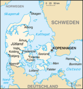
Dänemark

Finnland
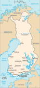
Finnland

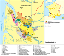
Frankreich
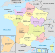
Frankreich (administrativ)
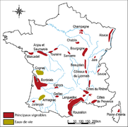
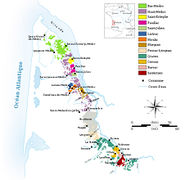
Frankreich (Weinanbau)
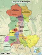
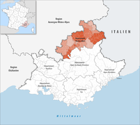
Auvergne
Baskenland
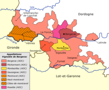
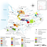
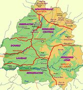
Bergerac (Weinanbau)
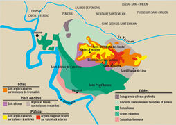
Bordeaux (Weinanbau)
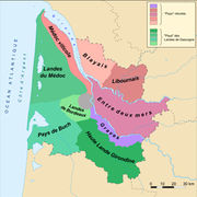
Bordelais

Bouche-du-Rhône-Arrondissements
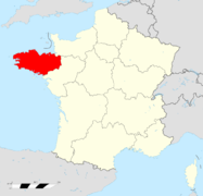
Bretagne
Burgund
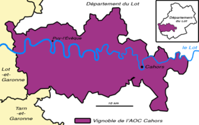
Cahors (Weinanbau)
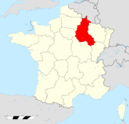
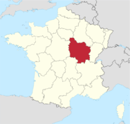
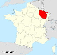
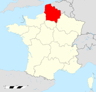
Champagne-Ardenne
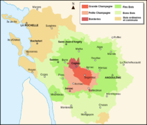
Cognac (Weinanbau)
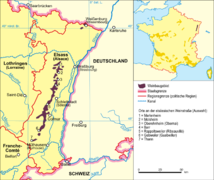
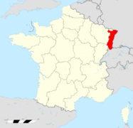
Elsass (Weinanbau)
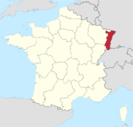
Elsass
Emilion (Weinanbau)
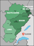
Franche-Comté
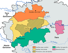
Gaillac (Weinanbau)
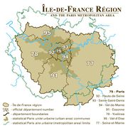
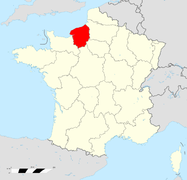
Ile-de-France
Jura (Weinanbau)
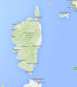
Korsika
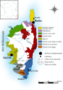
Korsika (Weinanbau)
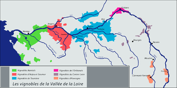
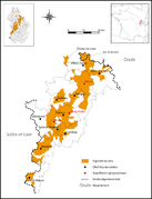
Loire-Tal (Weinanbau)
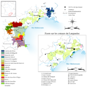
Languedoc (Weinanbau)
Lothringen
Médoc (Weinanbau)
Midi (Weinanbau)
Nord-Pas-de-Calais-Picardie
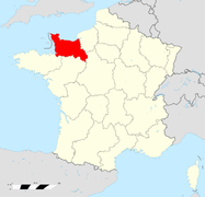
Normandie: Basse-Normandie
Normandie: Haute-Normandie
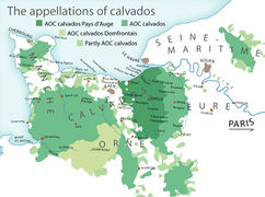
Normandie: Calvados (drei Appellationen)
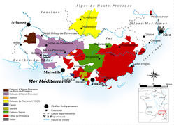
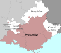
Provence (Weinanbau)
Rhônetal: Gesamt (Weinanbau)
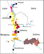
Rhônetal: Nördliches Rhônetal (Weinanbau)
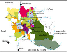
Rhônetal: Südliches Rhônetal (Weinanbau)
Savoyen
Südwest (Weinanbau)
_-_colored_2016.svg)


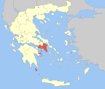
Griechenland
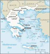
Griechenland
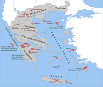
Griechische Weinregionen
Ägäisches Meer
Attika
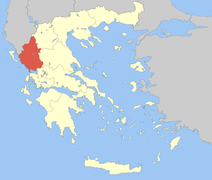
Epirus
Ionische Inseln
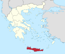
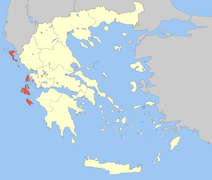
Kreta
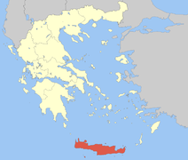
Kreta
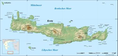
Kreta
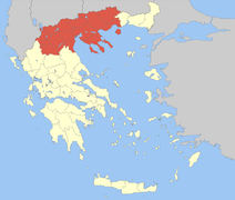
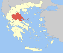
Makedonien
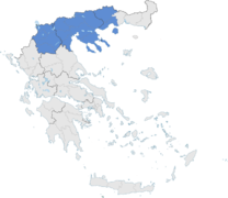
Makedonien
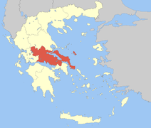
Mittelgriechenland
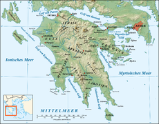
Peloponnes
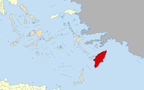
Rhodos
Thessalien
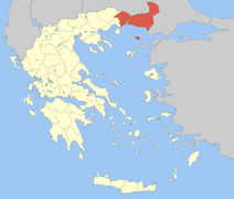
Thrakien
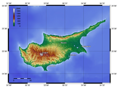
Zypern


.svg.png)


Großbritannien
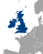
Britische Inseln
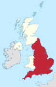
England
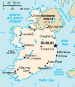
Irland
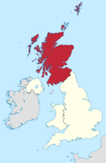
Schottland
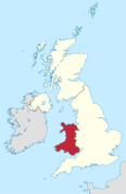
Wales


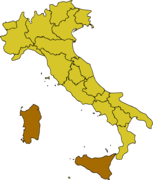
Italien
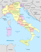
Italien (administrativ)
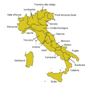
Regionen in Italien
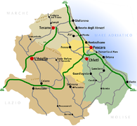
Abruzzen
Abruzzen
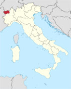
Aosta-Tal
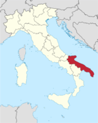
Apulien
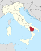
Basilikata
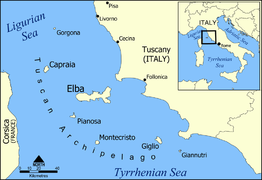
Elba
Emilia-Romagna
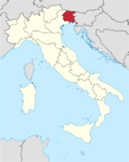
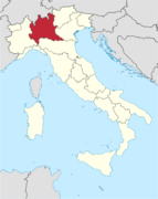
Friaul-Julisch Venetien
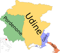
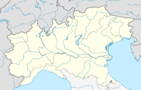
Die Provinzen Friauls
Insulares Italien
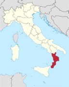
Kalabrien
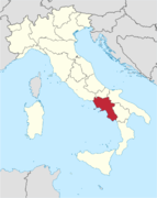
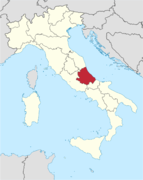
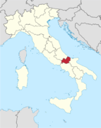
Kampanien
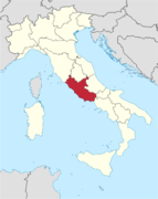
Latium
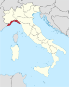
Ligurien
Lombardei
Marken
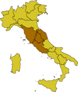
Mittelitalien
Molise
Norditalien
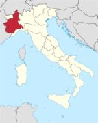
Piemont
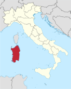
Sardinien
Sardische Provinzen
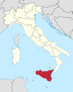
Sizilien
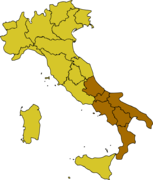
Süditalien
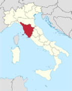
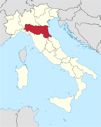
Toskana
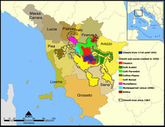
Toskana: Chianti-Zonen
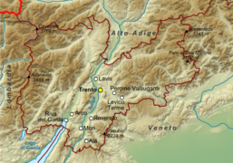
Trentino
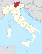
Trentino-Südtirol
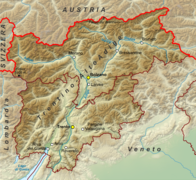
Trentino-Südtirol
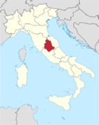
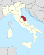
Umbrien
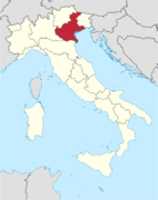
Venetien


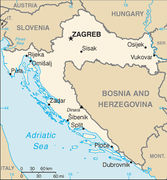
Kroatien
Kroatien

Luxemburg
Luxemburg

Malta
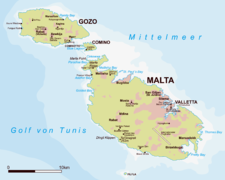
Malta

Moldawien
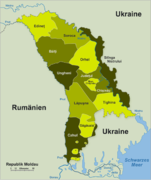
Moldawien

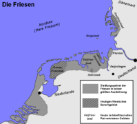
Niederlande
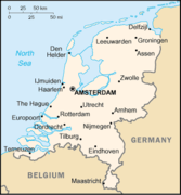
Niederlande
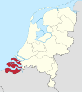
Niederlande: Zeeland
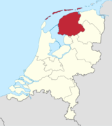
Niederlande:Friesland
.png)


Norwegen
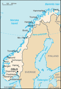
Norwegen

Österreich
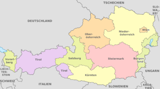
Österreich
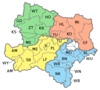
Österreichische Weinanbauregionen
Burgenland
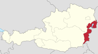
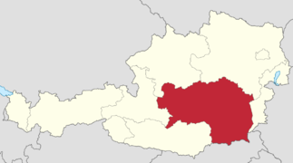
Niederösterreich
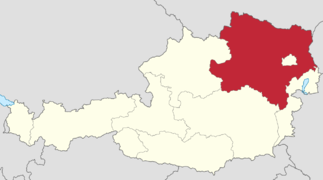
Niederösterreich
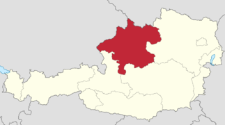
Oberösterreich
Salzburger Land
Steiermark
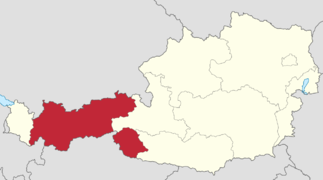
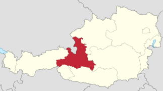
Tirol
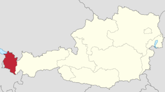
Vorarlberg


Polen
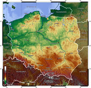
Polen, topografisch
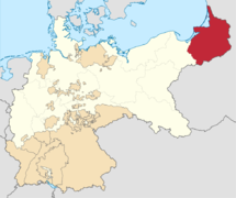
Polen: Ostpreußen 1871-1918

.svg)
Portugal
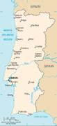
Portugal
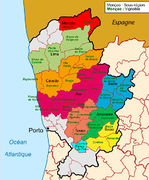
Portugal: Vinho verde
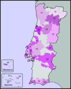
Portugal: (Weinanbau)
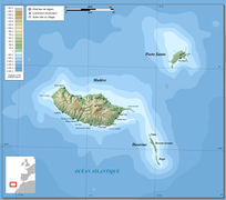
Portugal/Madeira


Rumänien
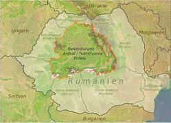
Rumänien

Russland
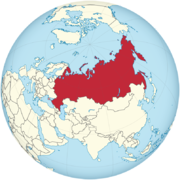
Russland

Schweden
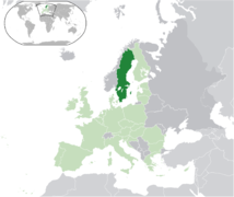
Schweden

Schweiz
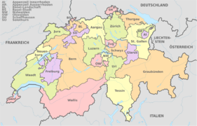
Schweiz (administrativ)
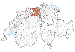
Kanton Aargau
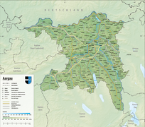
Kanton Aargau
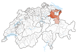
Kanton St. Gallen
Kanton Graubünden
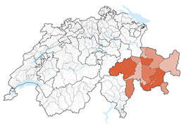
Kanton Tessin
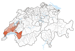
Kanton Waadt
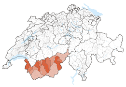
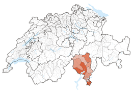
Kanton Wallis


Serbien
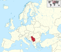
Serbien
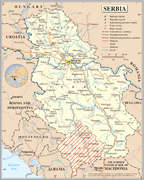
Serbien


Slowakei
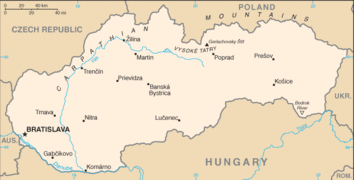
Slowakei
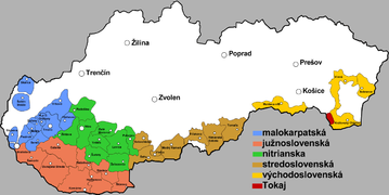
Slowakei (Weinanbaugebiete)


Slowenien
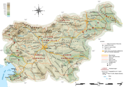
Slowenien
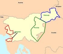
Slowenien (Weinanbau)


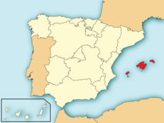
Spanien
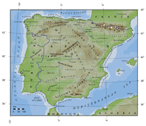
Spanien, gesamt
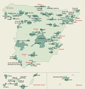
Spanien (Weinanbau)
Alella (Teneriffa)
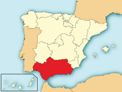
Andalusien
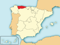
Asturien
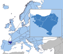
Baskenland (Region)
Baskenland (span.)
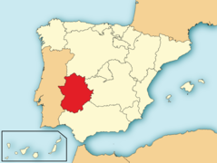
Extremadura
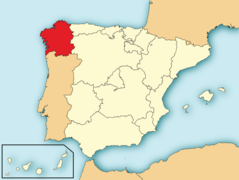
Galicien
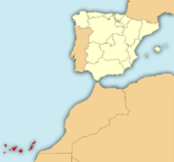
Kanaren
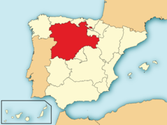
Kastilien und León
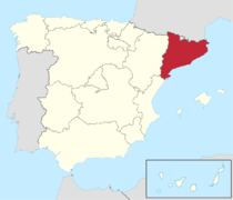
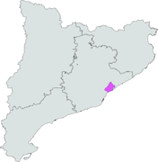
Katalonien
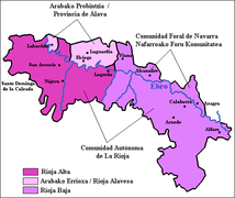
Rioja (Weinanbau)
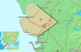
Sherry-Dreieck in Andalusien


.svg)


Tschechien
Tschechien

Ukraine
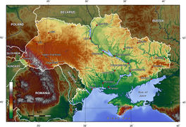
Ukraine

Ungarn
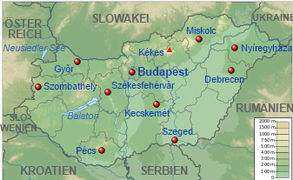
Ungarn
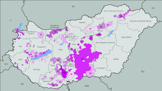
Ungarn (Weinanbau)


Asien
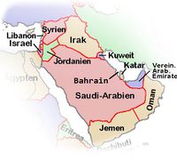
Arabien
Armenien
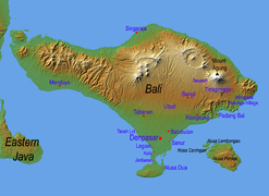
Bali
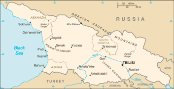
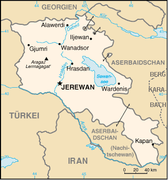
Georgien
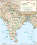
Indien
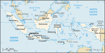
Indonesien
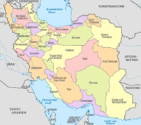
Iran
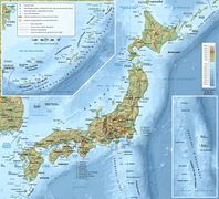
Japan
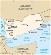
Jemen
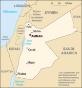
Jordanien
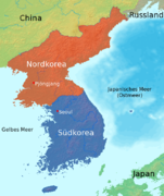
Korea
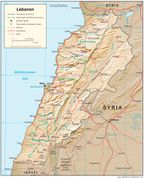
Libanon
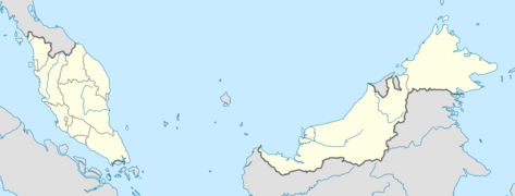
Malaysia
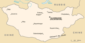
Mongolei
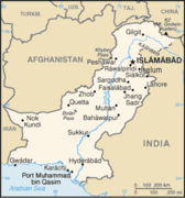
Pakistan
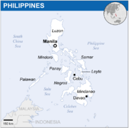
Philippinen
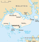
Singapur
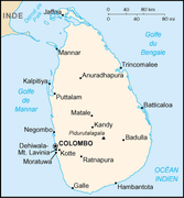
Sri Lanka
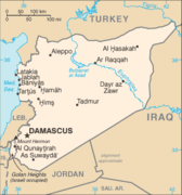
Syrien
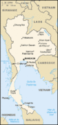
Thailand
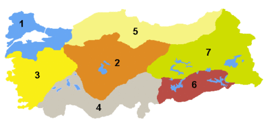
Türkei (Regionen)
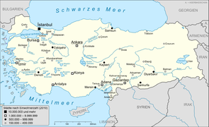
Türkei (größte Städte)
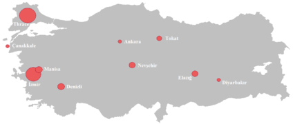
Türkei (Weinanbaubereiche)
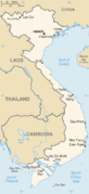
Vietnam


_-_PHL_-_UNOCHA.svg.png)
.png)


Afrika
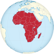
Afrika
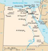
Ägypten
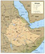
Äthiopien
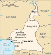
Kamerun
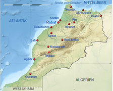
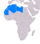
Marokko
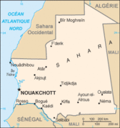
Mauretanien
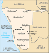
Namibia
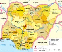
Nigeria
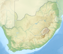
Südafrika
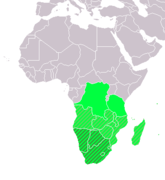
Südliches Afrika nach UN
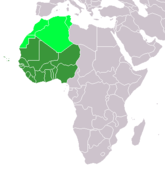
Westafrika
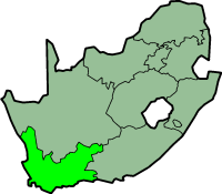
Westkap im Staate Südafrika
.svg.png)


Nord- und Mittelamerika
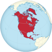
Nordamerika
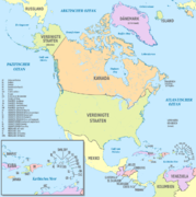
Nordamerika
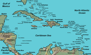
Antillen in der Karibik
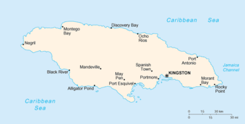
Jamaika
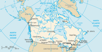
Kanada
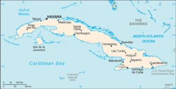
Kuba
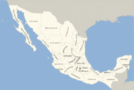
Mexico
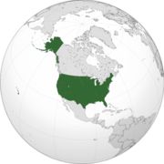
USA
.svg.png)
.svg)


Südamerika
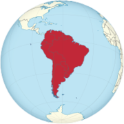
Südamerika
Argentinien
Brasilien
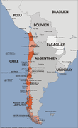
Chile
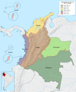
Kolumbien
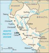
Peru
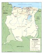
Suriname
.svg.png)


.svg)


Australien und Ozeanien
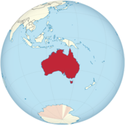
Australien
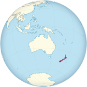
Neuseeland
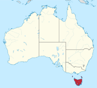
Tasmanien
_(Oceania_centered).svg.png)
.svg)

Medien in der Kategorie „Karten“
Folgende 200 Dateien sind in dieser Kategorie, von 247 insgesamt.
(vorherige Seite) (nächste Seite)- 1256px-Vorarlberg i… 1.256 × 700; 125 KB
- 2011 Dimos Rodou.png 2.000 × 1.253; 250 KB
- Abruzzo in Italy.svg 1.034 × 1.299; 1,67 MB
- Aegean Sea with isl… 350 × 465; 20 KB
- Africa on the globe… 200 × 200; 36 KB
- Alsace in France.svg 1.041 × 997; 1,65 MB
 Alsace region locat… 2.000 × 1.922; 529 KB
- AOC Gaillac appella… 2.049 × 1.605; 361 KB
- Aosta Valley in Ita… 1.034 × 1.299; 1,67 MB
- Appellations berger… 652 × 539; 104 KB
- Apulia in Italy.svg 1.034 × 1.299; 1,67 MB
- Arabische Halbinsel… 430 × 387; 53 KB
- Argentina map.png 330 × 732; 24 KB
- Armenien und Berg K… 331 × 355; 35 KB
- Australia on the gl… 330 × 330; 70 KB
- Austria, administra… 1.256 × 700; 653 KB
- Austrianwineregions… 572 × 476; 19 KB
- Bali Labeled.png 1.600 × 1.166; 1,4 MB
- Balkan6.png 529 × 431; 69 KB
- Basilicata in Italy… 1.034 × 1.299; 1,67 MB
- Basse-Normandie reg… 624 × 600; 91 KB
- Be-map-fr.png 330 × 355; 28 KB
- Berlin, administrat… 1.400 × 1.151; 783 KB
- Blank map of Mexico… 976 × 655; 268 KB
- Bordelais.jpg 668 × 668; 196 KB
- Bourgogne in France… 1.041 × 997; 1,65 MB
- Brandenburg, admini… 1.022 × 1.075; 414 KB
- Bretagne region loc… 2.000 × 1.922; 300 KB
- Brussels-Capital Re… 1.136 × 988; 127 KB
- Bulgaria Cities Map… 1.200 × 750; 824 KB
- Burgenland in Austr… 1.256 × 700; 318 KB
- Calabria in Italy.s… 1.034 × 1.299; 1,67 MB
- Campania in Italy.s… 1.034 × 1.299; 1,67 MB
- CaribbeanIslands.png 1.500 × 900; 577 KB
- Carte aoc cahors1.p… 640 × 403; 72 KB
- Carte cameroun fran… 330 × 355; 11 KB
- Carte Mongolie.png 630 × 320; 10 KB
- Carte topographique… 2.580 × 2.341; 1,11 MB
- Carte vignoble vall… 1.447 × 723; 284 KB
- Cartes des vins de… 752 × 746; 96 KB
- Cataluna in Spain (… 1.184 × 1.016; 1,16 MB
- Champagne-Ardenne r… 2.000 × 1.922; 539 KB
- Chianti-Zonen.JPG 1.000 × 769; 238 KB
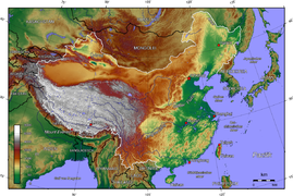 China topo.png 1.200 × 804; 1,35 MB
- CIA World Factbook… 326 × 350; 10 KB
- Cognac-Anbaugebiet.… 705 × 600; 102 KB
- Crete relief map-de… 3.370 × 1.599; 423 KB
- Cyprus topo.png 1.500 × 1.150; 1,01 MB
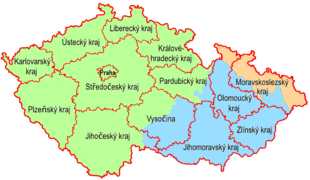
- CZ Cechy Morava kra… 805 × 468; 21 KB
- Daenemark.png 330 × 355; 18 KB
 Denmark islands.PNG 804 × 625; 172 KB
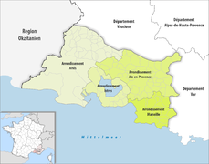 Département Bouche-… 2.500 × 1.970; 684 KB
- Deutschland Lage vo… 592 × 801; 108 KB
- Deutschland politis… 756 × 998; 229 KB
- Distrito Federal in… 2.008 × 1.984; 2,62 MB
- DO Alella.svg.png 500 × 511; 39 KB
- Egypt-map.png 327 × 350; 11 KB
- Ei-map.svg 652 × 756; 99 KB
- Emilia-Romagna in I… 1.034 × 1.299; 1,67 MB
- Emilion.jpg 881 × 626; 332 KB
- England in United K… 886 × 1.369; 2,25 MB
- Erzgebirge Naturrau… 1.079 × 661; 1,39 MB
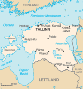 Estland-Karte-de.png 326 × 350; 15 KB
- Ethiopia shaded rel… 1.010 × 1.215; 222 KB
- EU-Sweden.svg 2.045 × 1.720; 2,61 MB
- Euskal Herria Europ… 815 × 700; 65 KB
- Finland map.gif 328 × 713; 25 KB
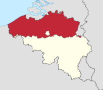 Flemish Region in B… 1.136 × 988; 276 KB
- France, administrat… 2.000 × 1.922; 1,84 MB
- Franche-comté admin… 600 × 804; 121 KB
- Franken Region Uebe… 1.180 × 825; 463 KB
 Friesengebiet.png 769 × 697; 135 KB
- Friesland in the Ne… 888 × 1.001; 470 KB
- Friuli-Venezia Giul… 1.034 × 1.299; 1,67 MB
- General map of slov… 1.952 × 1.372; 6,49 MB
- Georgien.png 634 × 324; 42 KB
- German Empire - Pru… 976 × 818; 767 KB
- German wine regions… 1.002 × 672; 211 KB
- Gr-map.png 326 × 350; 30 KB
- Greece wine regions… 1.000 × 849; 206 KB
- Grossgliederung Eur… 987 × 1.024; 1.014 KB
- Haute-Normandie reg… 624 × 600; 92 KB
 Hessen topografisch… 1.500 × 2.097; 5,39 MB
- Hr-map ITA2.png 328 × 353; 16 KB
- Ile-de-France jms.j… 638 × 638; 78 KB
- Indien physisch-pol… 1.408 × 1.712; 4,77 MB
- Indonesia map.png 636 × 326; 23 KB
- Iran, administrativ… 1.200 × 1.071; 650 KB
- Italia centrale.svg 735 × 867; 117 KB
- Italia insulare.svg 735 × 867; 117 KB
- Italia meridionale.… 735 × 867; 117 KB
- Italy North locatio… 1.240 × 792; 316 KB
- Italy, administrati… 1.034 × 1.299; 1,17 MB
- Jamaika.png 670 × 340; 8 KB
- Jordanien.png 351 × 377; 21 KB
- Kanada.png 631 × 321; 31 KB
- Karte chile verwalt… 900 × 1.469; 177 KB
- Karte der Türkei.png 1.500 × 916; 400 KB
- Karte Lage Kanton A… 4.133 × 2.848; 3,6 MB
- Karte Lage Kanton G… 4.133 × 2.848; 3,62 MB
- Karte Lage Kanton S… 4.133 × 2.848; 3,6 MB
- Karte Lage Kanton T… 4.133 × 2.848; 3,59 MB
- Karte Lage Kanton W… 4.133 × 2.848; 3,62 MB
- Karte Lage Kanton W… 4.133 × 2.848; 3,6 MB
- Karte Mittelmeeranr… 713 × 395; 908 KB
- Karte NOE Viertel B… 1.000 × 900; 67 KB
- Karte-Moldawien-Geb… 500 × 596; 137 KB
- Korsika.jpg 453 × 511; 114 KB
- Kriti in Greece.svg… 1.003 × 825; 201 KB
 Kroatien.jpg 327 × 352; 106 KB
- Kuba.png 634 × 323; 15 KB
- Lazio in Italy.svg 1.034 × 1.299; 1,67 MB
- Lebanon Physiograph… 1.986 × 2.458; 1,56 MB
- Liguria in Italy.svg 1.034 × 1.299; 1,67 MB
- Localización de And… 686 × 518; 502 KB
- Localización de Ast… 686 × 518; 501 KB
- Localización de Cas… 686 × 518; 502 KB
- Localización de Ext… 686 × 518; 501 KB
- Localización de Gal… 686 × 518; 501 KB
- Localización de la… 799 × 745; 638 KB
 Localización de las… 686 × 518; 502 KB
- Localización del Pa… 686 × 518; 502 KB
 Locatio.jpg 456 × 210; 35 KB
- Location map of Mac… 693 × 599; 128 KB
- LocationBritishIsle… 414 × 516; 9 KB
- LocationSouthernAfr… 360 × 392; 14 KB
- LocationWesternAfri… 360 × 392; 13 KB
- Locator map Lower-S… 592 × 801; 668 KB
 Locator map of Depa… 2.500 × 2.237; 984 KB
- Locator map Westfal… 657 × 656; 479 KB
- Lombardy in Italy.s… 1.034 × 1.299; 1,67 MB
- Lorraine region loc… 624 × 600; 91 KB
- Luxemburg Topograph… 1.216 × 2.000; 3,56 MB
- Madeira-Karte.jpg 545 × 480; 109 KB
 Maghreb.png 353 × 391; 12 KB
- Malaysia location m… 1.200 × 457; 499 KB
- Malta Gozo Comino.p… 2.000 × 1.600; 801 KB
- Map aoccalvados.jpg 621 × 462; 223 KB
- Map korea german la… 652 × 778; 505 KB
- Map of Baden (1819-… 1.954 × 2.881; 151 KB
- Map of region of Fr… 4.316 × 3.831; 102 KB
- Mapa de Colombia (r… 1.763 × 2.126; 1,48 MB
- Marches in Italy.svg 1.034 × 1.299; 1,67 MB
- Marokko.jpg 405 × 325; 117 KB
- Mauritanie carte.gif 329 × 353; 17 KB
- Medoc.jpg 602 × 586; 174 KB
- Molise in Italy.svg 1.034 × 1.299; 1,67 MB
- Namibiekaart.png 440 × 473; 36 KB
- Netherlands-CIA WFB… 330 × 355; 10 KB
- New Zealand on the… 791 × 790; 440 KB
- Niederösterreich in… 1.256 × 700; 127 KB
- Nigeria political.p… 567 × 482; 183 KB
- Nord-Pas-de-Calais-… 624 × 600; 81 KB
- Nördliches Rhônetal… 458 × 562; 97 KB
- North America on th… 200 × 200; 38 KB
- North America, admi… 1.181 × 1.185; 6,54 MB
- North rhine w LWL.s… 660 × 660; 221 KB
- Norwegen Ausschnitt… 330 × 477; 48 KB
- Oberösterreich in A… 1.256 × 700; 127 KB
- Pakistan.png 330 × 354; 14 KB
- Pays d'Auvergne map… 700 × 900; 404 KB
 Pays du Perigord.jpg 556 × 599; 93 KB
- Peloponnese relief… 2.000 × 1.566; 3,06 MB
- Periferia Attikis.p… 800 × 679; 92 KB
- Periferia Ionion Ni… 800 × 679; 92 KB
- Periferia Ipirou.png 800 × 679; 92 KB
- Periferia Kritis.png 800 × 679; 91 KB
- Periferia Stereas E… 800 × 679; 92 KB
- Periferia Thessalia… 800 × 679; 92 KB
- Perù CIA map.gif 328 × 354; 15 KB
- Philippines - Locat… 1.028 × 1.024; 204 KB
- Piedmont in Italy.s… 1.034 × 1.299; 1,67 MB
- Po-map.png 325 × 713; 46 KB
- Polen topo.jpg 1.400 × 1.364; 758 KB
- PosGreekMacedonia.p… 800 × 679; 103 KB
- PosGreekThrace.png 800 × 679; 103 KB
 Provence-Alpes-Cote… 2.732 × 2.367; 163 KB
- Regione Abruzzo Map… 800 × 738; 321 KB
- Regionen in Italien… 606 × 600; 127 KB
- Reliefkarte Aargau.… 2.117 × 1.871; 3,24 MB
- Rheinhessen Relief… 1.047 × 1.200; 1,28 MB
- Rioja-Gebiet.png 553 × 466; 19 KB
- Romania Regions Tra… 1.280 × 927; 1,04 MB
- Russland.svg 805 × 805; 311 KB
- Saarland karte neu.… 1.089 × 835; 460 KB
- Salzburg in Austria… 1.256 × 700; 318 KB
- Sardinia in Italy.s… 1.034 × 1.299; 1,67 MB
- Sardinia new provin… 972 × 1.287; 103 KB
- Savoyen.jpg 465 × 606; 298 KB
- Saxony-Anhalt, admi… 1.957 × 2.307; 696 KB
- Saxony, administrat… 2.068 × 1.508; 457 KB
- Schlesien.jpg 1.165 × 575; 291 KB
- Schleswig-Holstein,… 966 × 773; 523 KB
- Scotland in United… 886 × 1.369; 2,25 MB
- Serbia DisputedKoso… 2.502 × 3.135; 1,39 MB
- Serbia in Europe.svg 1.401 × 1.198; 4,04 MB
- Sherrydreieck.png 800 × 519; 375 KB
- Sicily in Italy.svg 1.034 × 1.299; 1,67 MB
- Siria-Mappa.png 328 × 352; 12 KB
- Slovacchia CIA map.… 634 × 323; 17 KB


